Mouza Plot & Land Measure BD
Find a Bangladesh Mouza map, look at it before you download it, and measure any plot on it: area in decimal (শতক), katha, bigha and acre, every side's length, and the perimeter. Plus khatian search and land calculators in the Tools tab. No account, no ads, and your plots stay on your phone.
Help me test Mouza Plot
The app is in closed testing on Google Play. If you'd like to help test it, the three steps below will get you started. অ্যাপটি এখন Google Play-তে ক্লোজড টেস্টিংয়ে আছে। টেস্ট করতে সাহায্য করতে চাইলে নিচের তিনটি ধাপ অনুসরণ করুন।
Tap Ask to join group to join the Mouza Plot tester community. ধাপ ১: Google গ্রুপে যোগ দিন। লিংক খুলে Ask to join group (বা Join group) চাপুন।
Open the Google GroupTap Become a tester to opt your Google account into the closed test. ধাপ ২: টেস্টার হোন। লিংক খুলে Become a tester চাপুন।
Become a testerOnce you're enrolled as a tester, install the app from Google Play using the link below. ধাপ ৩: Google Play থেকে ইনস্টল করুন। "অ্যাপ পাওয়া যায়নি" দেখালে ধাপ ১-এর পর কয়েক মিনিট অপেক্ষা করে আবার চেষ্টা করুন।
Install on Google Play- Please keep the app installed, and stay in the tester group, for 14 days.
- Try your own district: measure a plot you know on a Mouza map, and compare it on the Google map tab.
- If an area doesn't match your records, or anything is confusing, please tell me so it can be fixed before public release.
- ১৪ দিন অ্যাপটি ফোনে রাখুন এবং টেস্টার গ্রুপ ছাড়বেন না।
- নিজের এলাকার পরিচিত একটি জমি মৌজা ম্যাপে মাপুন, আর গুগল ম্যাপ ট্যাবে মিলিয়ে দেখুন।
- মাপ না মিললে বা কিছু বুঝতে অসুবিধা হলে জানাবেন, যাতে প্রকাশের আগে ঠিক করা যায়।
Feedback: [email protected]
Joining the group and closed test uses your Google account. You can leave the test at any time from Google Play's tester page.
From Mouza sheet to plot area
Everything a landowner or buyer needs to check a plot's size on the map, in the units used for land in Bangladesh.
Measure on the Google Map
Measure land on Google's satellite map too and compare it with the Mouza map. Opens at your location (optional); mark corners with the crosshair, by tapping, or by walking the boundary with GPS points.
Show on Satellite Map Pro · free during launch
Find your dag on the ground. Mark three or four landmarks on the Mouza map (road junctions, bridges, mouza corners), match them on the satellite map or by standing there with GPS, and see your plots laid over the satellite image. Compare areas, nudge the plots onto the fences you see, copy a plot to the Google map tab, or export it to Google Earth (KML/KMZ, GPS-matched landmarks only). Approximate: old maps were drawn by hand, and plots far from the landmarks drift.
Browse Mouza Maps
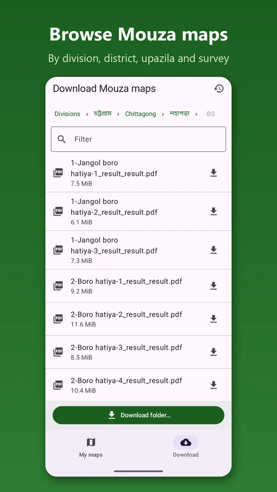
Scanned Mouza maps by division › district › upazila › survey (CS, SA, RS, BS). A filter box finds a mouza quickly, in Bengali or English digits. Two public map sources: if one is slow or down, switch to the other.
Preview Before You Download
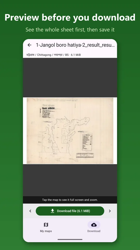
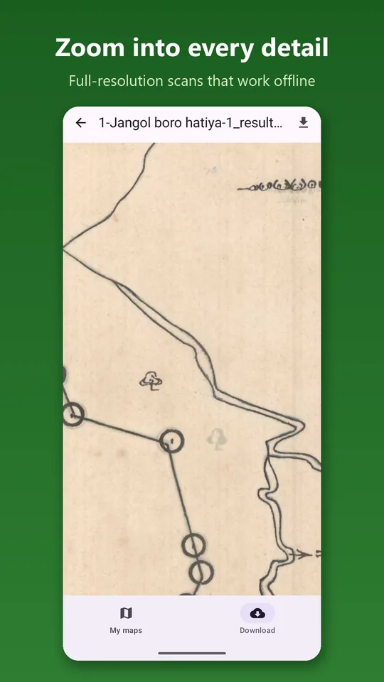
Open any map to see the whole sheet first, zoom in full screen, and step through the folder with Previous / Next. Download only the one you need.
Download One Map or a Whole Folder
Maps are saved in your Downloads folder and open without internet. Big folder downloads continue in the background; maps you already have are skipped.
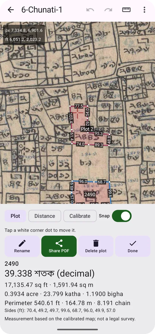
Measure Any Plot
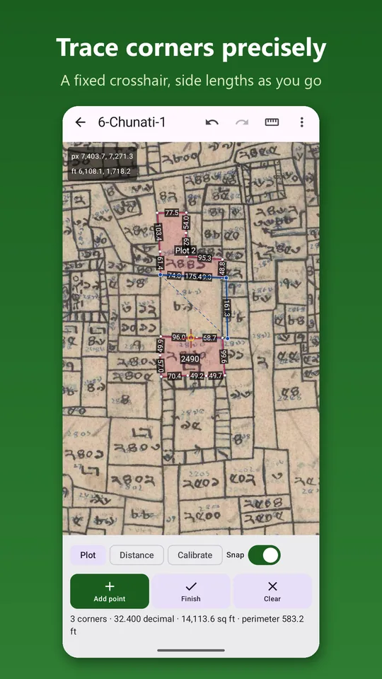
Long-press inside a plot and Smart Trace (beta) follows the printed lines and draws the outline in about three seconds. Or pan the map under a fixed red crosshair and add each corner, so your finger never hides the line. Move, add or delete corners, and undo or redo any change.
Bangladeshi Land Units
Area in decimal (শতক), square feet, square metres, acre, katha and bigha, plus kani–gonda for Chattogram, Noakhali and Sylhet (adjustable bigha and kani sizes). Side lengths in feet and inches (8′ 6″) or decimal feet, perimeter in feet, metres and chains.
Every Mouza Map Scale
16, 32, 64 or 80 inches = 1 mile: pick the scale printed on the map, at the scan's 400 DPI, or mark two ends of the chain scale bar. The app warns you if the two disagree.
PDF Reports & DXF
Share a PDF report of your plots with their areas and side lengths by WhatsApp or e-mail. Export to DXF to open the plots in AutoCAD.
Totals & Shares
Add up several plots, such as adjoining dags bought together, and divide the total into shares: equal heirs, a double share, or percentages, in every unit.
Khatian Search That Works on a Phone
Tap Khatian on a plot: its dag number is copied and the official DLRMS khatian search opens inside the app, with the division, district and upazila lists made easy to scroll on a phone, and arrow keys if a list gets stuck. Survey and namjari khatians. Or open the Ministry of Land's own apps.
Land Tools
A unit converter (decimal, katha, bigha, kani, chotak, acre, sq ft; feet, hat, link, chain), share division and a land price calculator in lakh and crore. Links to e-mutation, land development tax and the government's inheritance calculator.
Backup & Restore
Save every map and plot to one file on Google Drive, a PC or a memory card, and bring them back on a new phone. Still no account: the file goes only where you put it.
English and বাংলা
The whole app, including numbers, in English or Bengali. Also opens your own scanned maps: PDF, JPG or PNG.
Three steps to a plot's area
Find the map
Browse to your mouza, preview the sheet, and download it. Or open a scanned map you already have.
Set the scale and trace
Confirm the map scale, zoom in on your plot, and add a point at each corner with the crosshair.
Read the area and share
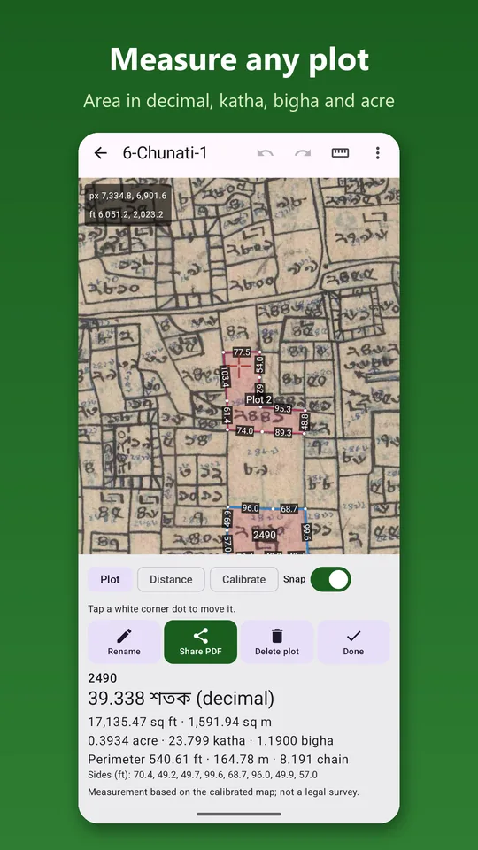
See the area in decimal, katha and bigha as you go. Name the plot by its dag number and share a PDF report.
The User Guide walks through every step.
See it on a real Mouza map
No account, no tracking
Mouza Plot collects nothing about you. Your maps, plots and measurements stay on your phone. The app goes online to list and download maps, to show the Google map and to open the government land services you choose, and it never sends your plots or your location to us.
Read Full Privacy Policy →- No account, no sign-in, no registration
- No analytics, no advertising, no crash reporting
- Plots, dag numbers and settings stay on your phone
- Measuring works without internet
- Location is optional, used only on your phone for the Google map tab
- Government land services open official apps and websites; what you type there goes to them, not to us
- Never asks for contacts, camera or microphone
- Reports are created only when you ask, and go only where you send them
What the app asks for, and why
Location only if you allow it, for the Google map tab. No contacts, no camera, no microphone, no SMS, and no broad storage access on current Android versions.
Official sources: Directorate of Land Records and Surveys (DLRS): dlrs.gov.bd · official Mouza maps and khatian, to search and order: dlrms.land.gov.bd · Ministry of Land, land information: land.gov.bd