Find Your Plot on the Satellite Map from an Old Mouza Map
You know the plot (dag) number and you have the khatian, but standing in the field you can't tell which piece of land is yours. Heirs, new buyers and owners living far away all know this problem. Laying the Mouza map's plots over a satellite image now gives you a first answer on your phone.
Land left by a father, a plot bought from abroad, an ancestral homestead you haven't seen in years: the papers are all there, but out in the field every rice paddy and ridge looks the same. The plot is clear on the Mouza map, yet matching that old drawing to today's roads and houses is hard.
The idea behind the fix is simple. Match a few places that appear on both the Mouza map and the satellite image, and the rest of the map's plots settle onto the satellite image in roughly the right place. "Roughly" is the word that matters most here, and this guide is open about why.
How it works: matching landmarks
On the Mouza map, pick a few places that still exist on the ground: road junctions, bridges, culverts, canal crossings, mouza boundary corners. These are your landmarks. Then show where each one is today, either by finding it on the satellite image or by standing on it and using your phone's GPS. Two matched landmarks are enough to place the map; a third and fourth give a check, showing how many metres each landmark is off.
Why it is always "approximate"
Old Mouza maps were drawn by hand, copied by hand many times, and the paper has shrunk unevenly over the years. So not every part of a sheet is equally to scale. Plots near the landmarks fit best; plots far from them drift and can turn slightly. What you see is not an official boundary or survey. For anything legal, rely on a licensed amin and your land office.
Learned in the field: put landmarks near the plot
In the first field test, in a village in Chattogram, two landmarks were placed far from the plot. The plot near the landmarks landed in the right place, but plots further away drifted in distance and a little in angle. The fault wasn't the calculation; it was the hand-drawn sheet. So the advice changed:
- Mark three or four landmarks close to the plot, about 100 to 300 metres away.
- Put them on different sides. With every landmark on one side, the other side drifts.
- Choose things that don't move. Avoid riverbanks and pond edges; they shift over the years.
Step by step
1. Get the map's scale right first
The Mouza map you measured on needs the right scale, ideally checked against the chain scale bar. With the wrong scale, no amount of landmark matching will help.
2. Mark landmarks, at home if you like
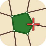
Put the crosshair on a road junction, bridge or mouza corner on the Mouza map and mark it. You can do this before you ever go to the field.
3. Match each landmark
Zoom into the satellite image until the junction or bridge is clear and set it there, or go to the field, stand on the exact spot and match it with GPS. GPS matches are more reliable, and the phone shows how far away each landmark is.
4. See your plots and compare
Once two landmarks are matched, your measured plots appear on the satellite image. Tap one to compare its area on the Mouza map with its area as placed, and check whether it lines up with the fences and ridges you can see.
5. Adjust by hand if you need to
If a far plot is slightly off, shift or turn it until it sits on the fences you see. That helps you read the picture, but remember that the position now comes from your own judgement, not from the map.
In Mouza Plot & Land Measure BD: Show on satellite map
Open a calibrated Mouza map and tap ⋮ › Show on satellite map (Pro · free during launch). The Mouza map and Google's satellite map appear together. Place landmarks with Mark, then match them with Set here or GPS; the app shows how many metres each landmark is off and whether the points agree with the map scale. Your plots appear in yellow; compare areas, or copy a plot to the Google map tab to fine-tune its corners. Adjust the placed plots shifts them 0.5 m at a time and turns them by 0.1° or 0.25°. When every landmark was matched by GPS on the spot and nothing is adjusted by hand, the plots can be exported for Google Earth (KMZ/KML). A caution about approximate placement appears every time the screen opens, and landmarks and matches stay on your phone.
The app is currently in closed testing on Google Play and is not publicly available yet. If you'd like to try it early and help shape it, you can join the test from the app page.
Learn more & join the testWhy Google Earth export needs GPS landmarks
Landmarks you place by tapping on the satellite image are fine for viewing inside the app. But Google's terms don't allow positions taken from its imagery to be carried out of the app. So a Google Earth file can only be made when every landmark was matched by GPS while standing on the spot, with no hand adjustment. Then the position is entirely your own measurement.
Mistakes to avoid
- Landmarks far away. Two junctions a kilometre off will let the plot drift. Use close landmarks, all around it.
- Places that have changed. Riverbanks, ponds and newly cut roads won't match an old map.
- The wrong scale. If the Mouza map's scale is wrong, the plots on the satellite map will be the wrong size too.
- Treating the result as the boundary. This helps you find the land. For placing boundary posts, possession or a dispute, the amin's measurement is final.
The short version
Three or four permanent landmarks close around the plot, on different sides, matched by GPS where you can: that is enough to find an old Mouza map's plot on today's satellite image, roughly. "Where is the land?" gets its first answer on your phone; the final answer comes from an amin and the land office.
Related reading
Frequently asked questions
How accurate is a plot placed on the satellite map?
Plots near the landmarks usually fit well; plots further away can be a few metres off, because the old sheets were hand-drawn and the paper has shrunk. The app shows how many metres each landmark is off. It is for finding the plot, not for fixing a boundary.
Can I do this without going to the field?
Yes. If a junction or bridge is clearly visible on the satellite image, you can match the landmark there. For Google Earth export, and for better accuracy, matching by GPS on the spot is better.
Is my location or are my landmarks sent anywhere?
No. Landmarks, GPS matches and adjustments stay on your phone. Your location is used only when you tap GPS, or to show how far away a landmark is. The satellite imagery is shown by Google Maps; the privacy policy has the details.
Does this feature cost money?
Show on satellite map is a Pro feature, but it is free during the launch. Browsing Mouza maps and measuring in the rest of the app are free.